Airport infrastructure is vital for the safe and efficient movement of passengers, cargo, and aircraft. As the aviation industry continues to grow, accurate and updated data about airport infrastructure becomes essential. One of the most promising technologies for this purpose is Light Detection and Ranging (LiDAR). This post delves into the usage of LiDAR data for accurate 3D modeling of airport infrastructure and its subsequent analysis.
What is LiDAR?
LiDAR is a remote sensing method that uses light in the form of a pulsed laser to measure variable distances to the Earth. These light pulses, combined with other data recorded by the airborne system, generate precise, three-dimensional information about the shape of the Earth and its surface characteristics.
Why use LiDAR for Airport Infrastructure?
High Accuracy and Detail: LiDAR can capture detailed and accurate topographical data, making it ideal for modeling complex infrastructures like airports. Unlike traditional methods, LiDAR can capture millions of data points in seconds, leading to high-resolution 3D models.
Rapid Data Acquisition: The speed of data collection with LiDAR means that large areas, like airports, can be mapped in a fraction of the time it would take with other methods.
Safety and Non-Intrusiveness: Using LiDAR means that data can be captured from a distance, without the need for physical access to potentially dangerous or restricted areas.
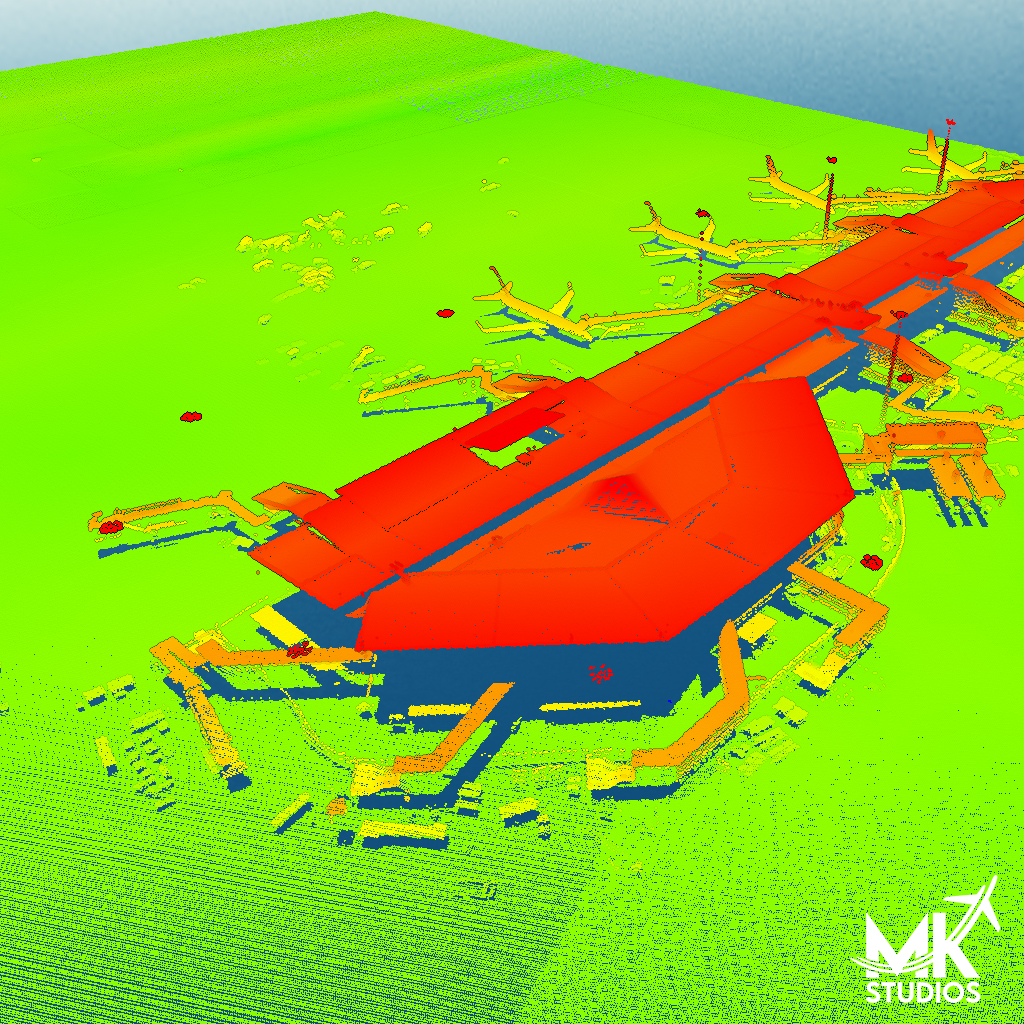
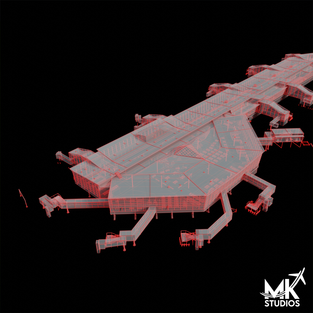
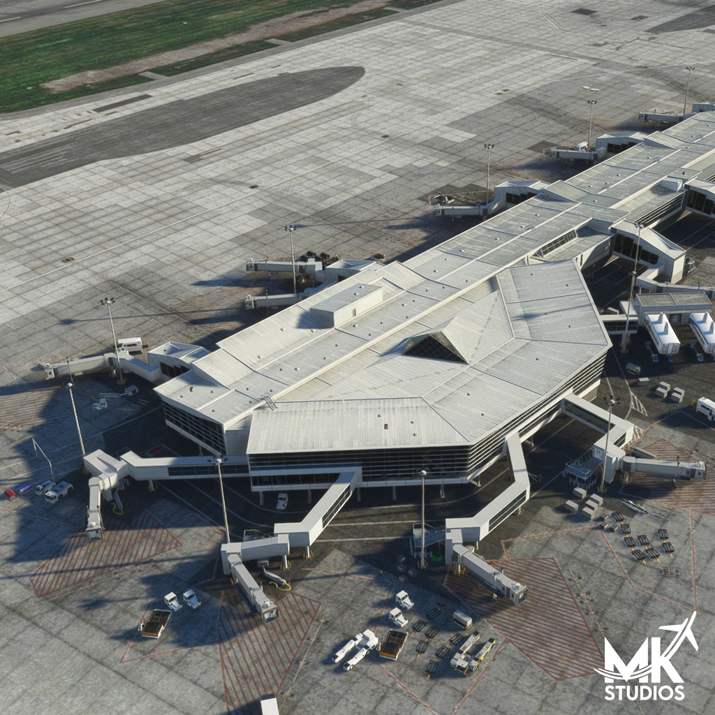
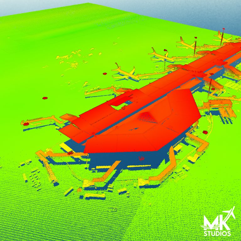
Below we present a part of the scan used for 3D modeling and the final result.